In February, the National Oceanic and Atmospheric Administration’s Office of Coast Survey released a draft version of its “National Charting Plan — A Strategy to Transform Nautical Charting.” The plan sets forth NOAA’s priorities to optimize nautical charting products for use in the digital age through improved content, coverage and access to chart data.
Coast Survey produced the first complete nautical chart (New York Harbor) in 1844, and except for a few notable changes, such as adding color, improved printing technology and the distribution of notice to mariners, nautical charts had changed little until the popularization of global positioning systems (GPS) in the 1990s. Even then, the first widely used digital nautical charts — raster navigational charts (RNCs) — were essentially electronic replicas of paper charts designed to fit specific bodies of water on fixed-sized sheets of paper.
The 1990s also introduced the world to electronic navigational charts (ENCs), but it took about 10 years for NOAA to offer the complete suite of over 1,000 ENCs needed to cover U.S. waters. In order to build ENCs quickly to meet International Maritime Organization mandates for their use, most hydrographic offices around the world digitized their paper charts into the ENC format. Furthermore, the complex nature of maintaining ENC data forced many hydrographic offices to continue the practice of copying paper chart data to apply ENC updates. This practice resulted in ENCs that essentially mirrored the paper charts from which they were created, preventing mariners from realizing the complete benefits of ENC data.
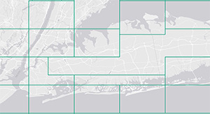
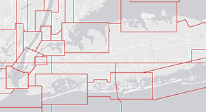
The mariners’ experience when navigating with ENCs should be seamless, even though they are continually transitioning from one ENC cell to another. However, since the NOAA suite was constructed cell by cell from paper charts, adjacent ENCs often have inconsistencies, such as depth contours that do not line up, differences in data density and unnecessary changes in scale. Re-scheming our ENC suite from 131 different scales down to fewer than 20, as proposed in the plan, would simplify maintenance of the suite and enable Coast Survey to more easily resolve irregularities between charts.
Another commitment described in the charting plan is to reduce unwarranted ECDIS alarms. Excessive alarms reduce users’ confidence in ENC data and can result in mariners ignoring all ECDIS alarms. Again, largely a symptom of data collection from paper products, one example is when ECDIS replaces traditional non-dangerous wreck symbols with the unique ECDIS isolated danger symbols. This occurs when wrecks in deep water were collected from paper charts that showed no depth for the wreck. The missing depth value in the ENC causes ECDIS to portray the feature with a conspicuous isolated danger symbol and initiate an alarm if a ship’s path will cross it, despite the wreck being safely far below the ship’s draft. Coast Survey is undertaking an effort to estimate and populate safe clearance depth values for all wrecks deeper than 66 feet (20 meters) to eliminate display clutter and these types of alarms.
In the draft plan, Coast Survey re-commits to working with the U.S. Army Corps of Engineers (USACE) to streamline the application of federal channel data. Coast Survey views the USACE eHydro initiative as an essential tool in updating nautical charts with the best available data for federally maintained channels. As the eHydro framework comes online, Coast Survey has started evaluating how charts display channel data, and would like to standardize their portrayal on ENCs. Also under consideration is how channels might be displayed on paper charts. If paper is used primarily for recreation and as a backup to ECDIS, USACE project depths may be all that is needed on paper. If so, this would greatly reduce, if not eliminate, paper chart and notice to mariner updates.
 |
The draft plan introduces a new Web service to help mariners visualize where changes to nautical charts have been made. ENCs and raster charts are updated weekly in a digital format and include all routine changes and critical dangers to navigation. This new process is meant to make life easier for mariners by eliminating the need for them to hand-correct charts. They can either update their paper chart manually or order a new one from a NOAA-certified chart agent if they decide the number of changes is too extensive.
The United States is one of the only countries in the world that show depths on paper nautical charts in feet and fathoms. The ease of being able to choose display units in the digital production environment offers an opportunity to transition nautical chart soundings to meters. The intent is to better support international commerce by showing soundings and depth contours in integer metric values. When using digital data, mariners will still be able to choose their preferred units.
As part of Coast Survey’s open data policy, we will improve access to marine data and information in formats for non-navigational use. The ENC Direct to GIS website serves ENC data in a number of GIS and CAD formats. Coast Survey plans to expand its marine spatial data infrastructure by offering comprehensive hydrographic survey data and authoritative theme layers extracted from nautical charts. Our hope is that this will help serve non-charting interests, such as survey planning, fisheries regulation, route optimization and site selection for renewable energy, oil and gas.
Coast Survey recently entered into an agreement with the International Centre for Electronic Navigational Charts to strengthen its distribution network and improve ENC quality control by employing ISO-certified processes for ENC data validation. This is part of an ongoing effort to improve product quality prior to distribution.
The draft National Charting Plan is in the process of being finalized and is available on the Coast Survey website: www.nauticalcharts.noaa.gov/.
John Nyberg is chief of the Marine Chart Division at NOAA’s Office of Coast Survey.

