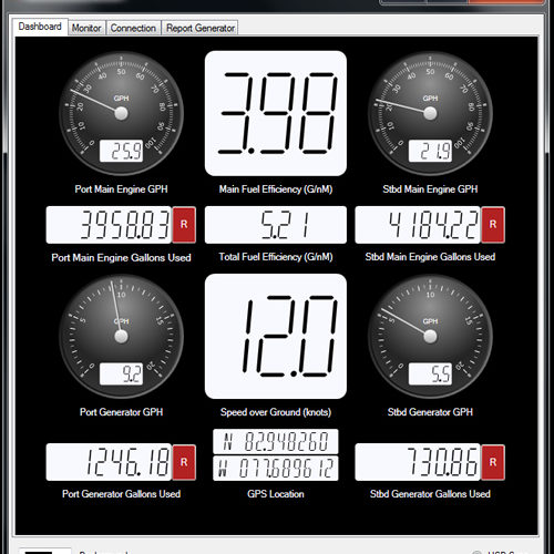
(SEATTLE) — FloScan's proprietary DataLog fuel monitoring software now has built in geo-fencing capability that can automatically track fuel used when transiting through an unlimited number of geographic areas set to correspond to various tax rates and regulatory authorities. The DataLog fuel monitoring software is included at no charge with every FloNET fuel monitoring system.
Operating commercial vessels on inland waterways requires accurate fuel consumption tracking for paying an array of fuel use taxes under the Inland Waterways Revenue Act in addition to those imposed by states and local jurisdictions. In most cases, these taxes apply only to fuel used for propulsion and is based on gallons burned while transiting specific areas. The complexity of tracking fuel burned for tax purposes has been time consuming and sometimes is little more than guesswork.
Geo-fencing is a software feature that uses GPS to define a set of geographical boundaries. DataLog software was developed to provide minute-by-minute tracking of a vessel's fuel consumption broken down by propulsion and non-propulsion engines, engine operational data and GPS-based vessel positioning. This information is provided by onboard FloScan fuel sensors on the vessel's engines and positional information is derived by linking the FloNET NMEA 2000 hub to the vessel's GPS system. The data is collected and cataloged by DataLog in a spreadsheet format that allows the fleet system administrator to easily incorporate geographical triggers so when the vessel enters one predefined boundary the program will record propulsion fuel consumption on a minute-by-minute basis until it exits that area and crosses into the next predefined area.
The data captured can be quickly retrieved directly from the system or via preset broadcast email uploads to fleet operations for ease of use in various types of government tax filings.

