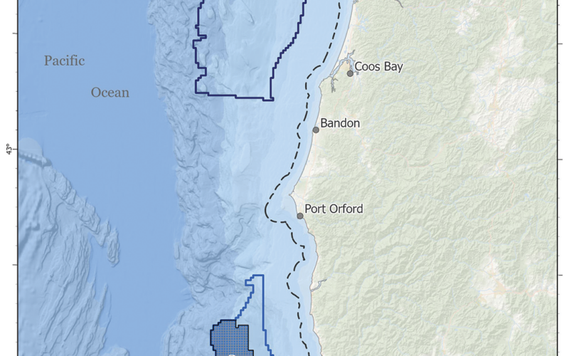
The two Wind Energy Areas encompass a combined 195,012 acres of water off the coast of Oregon.

The two Wind Energy Areas encompass a combined 195,012 acres of water off the coast of Oregon.

BOEM (Bureau of Ocean Energy Management) has designated two final Wind Energy Areas (WEAs) for development off the Oregon coast.

The Coos Bay WEA covers 61,204 acres approximately 32 miles offshore, while the Brookings WEA is 133,808 acres in size and is located about 18 miles off the coast, close to the border with California. 

If fully developed, the final two WEAs could support 2.4 GW of energy production, the BOEM said.  

The agency, part of the Department of the Interior, utilized “a comprehensive process to identify the potential offshore locations that appear most suitable for floating offshore wind energy leasing and potential development, taking into consideration the possible impacts to local coastal and marine resources and ocean users.”

The BOEM coordinated with the State of Oregon and collaborated with the National Oceanic and Atmospheric Administration’s National Centers for Coastal Ocean Science (NCCOS) “to engage with indigenous tribes, coastal communities and ocean users to assess opportunities for wind energy development and reduce or avoid impacts on other important ocean uses in Oregon.”

The agency announced the first public comment period on the two proposed Oregon WEAs in August 2023. 

Initially, the Coos Bay WEA was significantly larger than the designated Brookings area, but the Department of Defense “identified 570,053 acres in the Coos Bay Call Area that conflict with national security,” which reduced it by 65.3 percent. 

The WEAs also avoid 98 percent of the areas that the National Marine Fisheries Service and the Oregon Department of Fish and Wildlife recommended for exclusion “due to their importance as commercial fishing grounds.” 

Working together, the different agencies were able to finalize “a comprehensive, ecosystem-based ocean planning model that leverages the best available data on natural resources, ocean industries like fisheries and energy production, and areas of national security activities to identify sectors with high wind energy potential and fewer possible impacts to other ocean users and sensitive environmental resources,” the BOEM said. 

This inclusive approach “provided valuable insights about the seascape and its uses and facilitated greater transparency and positive coordination with government partners and ocean stakeholders through direct engagement and incorporation of their feedback into the NCCOS model,” the agency said.